
In the 1180s, a certain Minamoto no Yoritomo (源頼朝) overcame the Taira clan in a national power struggle, and established a bakufu – that is, a military government – in eastern Japan, for the first time eclipsing the power of the emperor in Kyoto. The Kamakura Period, as the ensuing age of military rule became known, was named for Minamoto's chosen stronghold of Kamakura (鎌倉), a few kilometres south of Tokyo, and generated many of the forces that would shape and symbolise Japanese life for centuries to come: the rule of shoguns; the rise of the samurai class and the Japanese feudal system; and the flowering of Japanese Buddhism, among others. After Yoritomo's death the shogunate fell under the dominance of his wife's Hōjō clan, which is perhaps best known for organising Japan's successful resistance to the Mongol invasions of Kublai Khan.
To anyone who has travelled around Tokyo and its environs, Kamakura should be instantly familiar. Effectively the capital of Japan for a century and a half, it is today a beacon of tourism and popular culture and is saturated with hundreds of historic temples and shrines.
Less celebrated however are Kamakura's wooded, rocky hills – perhaps unfairly, as it was these, which surround the town on three sides with the sea on the fourth, that convinced Yoritomo to establish his power base there. Indeed, Kamakura's geography made it a nigh-unassailable stronghold. It was so inaccessible that the only ways in before the rails and roads of today were the “Seven Entrances”, each a narrow pass artificially carved from the rock.


These surroundings make for some superb walking, and the route that follows is a day-long kaleidoscope of nature, culture and history. It sets out from Kamakura Station and links the hiking trails of the eastern, northern and western hills into a single loop, by which you can encircle the town, dropping by a few less prominent pieces of its heritage along the way, before winding down with a stroll along the beach. Even if you have visited Kamakura before, you may have missed the shrines or temples covered here, but they are no less intriguing than its greatest landmarks, and certainly no less historically pivotal.
 |
| They include a shrine overflowing with foxes... |
 |
| ...some exceptional examples of traditional Zen garden design... |
 |
| ...and an unassuming spot in the woods, where the Kamakura Shogunate came to a bloody end in 1333. |
Kamakura Hills
Length: Long. I do not have an exact measurement but would estimate at least 15km.
Hiking Time: Give yourself at least 7-8 hours to cover both hiking time and the places of interest along the way. Allow more time if you would like to look at these more closely.
Height: The highest point is Ōhirayama at only 159.2m. However there is a fair deal of up and down throughout the walk.
Access: Take the JR Yokosuka Line to Kamakura Station (鎌倉駅).
As these details suggest, this walk is long. Allow yourself a whole day if you are planning to do it in full, and go ready for a good workout. On the other hand, you are never too far from the town. There are shops or vending machines within bearable distance at any point on the route, and the many train stations or bus stops let you curtail it early if need be, or select portions to do at your own discretion.
Stage 1: Gionyama Trail
From Kamakura Station, go out through the east exit and turn right, going around the bus terminal and south down this side street with cafés and shops.

Your first concern is to snake through the streets of the town to reach the east hills. Exit the side street left to come to Kamakura's main north-south road. Cross and turn right, walking south for a few minutes till you come to this rail bridge next to a Lawson convenience store.

Go left just before the bridge, then left again at the level crossing. Keep going along this road past a traffic light, then turn left at the signpost to Yagumo Shrine (八雲神社), which will be immediately on your right.

This little shrine is in fact an offshoot of the great Yasaka Shrine in Kyoto. It was built by Minamoto no Yoritomo's great-great-grandfather in the late eleventh century, to pray for an end to an epidemic raging across the town at that time. As with the shrine in Kyoto, it is also known as the Gion Shrine, and thus gives its name to the hiking trail up the east hills – the Gionyama Trail – which starts in its grounds.
 |
| Yagumo Shrine (八雲神社). |
To find the trail, look to the right of the main shrine building for a little alleyway. The trailhead is just to the right of the rear torii.
 |
| Start of the Gionyama Trail. |
This steep wooded path takes you shortly to the top of the ridge. Immediately on the right is an overlook with nice views across southern Kamakura and the bay.


Here then is the first and most straightforward arc of the circuit. Head north, up the gentle trail along the wooded ridge for about half an hour.


When the path starts descending, it will in due course come to a fork. Turn left. Immediately on your left will be a cave in the rock with a little monument inside.

This is a yagura, the first of many more you will see today. These cave tombs in the rock are all over Kamakura, from the surrounding hills to the cliffs behind temples. It is thought they were dug for the dead due to the scarcity of flat land in this area, although their use declined after the Kamakura Period.
Proceed down to where the path emerges into a residential back street. On your right, just before leaving the woods, is a particularly special yagura.

This is the Takatoki Harakiri Yagura (高時腹切やぐら). Harakiri may be familiar as the traditional form of Japanese ritual suicide – literally “stomach-cutting”. The reason for this name is that this, it is said, is where Hōjō Takatoki, the last regent of the Kamakura Shogunate, disembowelled himself as the flames of his burning city filled the horizon. The city, not so impregnable after all as it turned out, fell at last in 1333 to a siege by imperial loyalists led by Yoshisada Nitta.
By this time, the Kamakura regime of the Hōjō clan had substantially weakened. The two Mongol invasions of 1274 and 1281, though famously defeated, cost the Hōjōs enormously in military mobilisation and sea defence construction. So too were they ever resented by the imperial court in Kyoto, and Nitta's invasion in 1333 was just the last of a whole string of attempts by one emperor after another to dislodge them.
Just up ahead, on the right of the road, is a fenced-off patch of overgrown grass. Here once stood Tōshō-ji (東勝寺), the ruling Hōjō clan's family temple. As their city fell and their rule collapsed, they and their samurai – almost 900 people in total – retreated to the temple, barricaded themselves inside, and set it on fire. All of them perished within.
 |
| The remains – of which not many are evident - of Tōshō-ji (東勝寺) temple. |
Perhaps it is surprising then that these grounds, where the Kamakura Period came to this horrific end, now sit silently in this sleepy residential neighbourhood, off the itineraries of most of Kamakura's visitors except for those who know the story and actively seek them out. I encountered not a soul here save for one elderly local gentleman, paying his respects at Takatoki's end.
Thus finished the first of Japan's three great shogunates, as well as the power of the Hōjō clan forever. But their story does not quite end yet. Keep going along that street, over a canal, to reach the main road, and turn right. After a few minutes you will reach another temple, Hōkai-ji (宝戒寺), on your right.

After the Hōjō family's brutal demise in 1333, it was said that their furious ghosts had lingered to haunt that area. Therefore the emperor ordered Takauji Ashikaga, later the first shogun of the Ashikaga (or Muromachi) Shogunate, to build this new temple as the Hōjō clan funerary site. As claims about the hauntings continued, a small shrine was built next to the main hall to placate the Hōjō ghosts, making this an uncommon instance where a Shinto shrine stands in the grounds of a Buddhist temple. Apparently a memorial service to the Hōjō still takes place here every year.
Stage 2: Ten'en Trail
Continue north along the main road as it curls to the right, crossing when you can. After about ten minutes a large red torii will appear on the left. Go through it up the tree-lined path, then take the first right and head straight on up this smaller street.
There will soon be a signposted junction, where you can take a quick left if you want a look at Kamakura-gū (鎌倉宮). This is a more recent shrine, built by the Meiji Emperor in 1869. It commemorates Prince Morinaga, who was decapitated in a cave on that site at age 26 – and whose grave is nearby – during the power struggles of the Kenmu Restoration, which followed the fall of the Kamakura Shogunate. This was a three-year struggle by the emperor to restore the power of the imperial house – but it failed, and military government continued under the Ashikaga Shogunate. Indeed, it was not until the Meiji Restoration, over 500 years later, that the office of the emperor would again come to hold political power.
 |
| Kamakura-gū (鎌倉宮). |
Returning to the junction, continue east. After passing a tennis club, a large green space opens up on the left, where Yōfuku-ji (永福寺) used to stand. This was a temple established by Minamoto no Yoritomo, dedicated to the samurai who fell in his conflicts with the Taira and Fujiwara clans. It was inspired by part of the Chūson-ji temple in Hiraizumi, Iwate, which impressed him greatly, and eventually expanded into a great temple compound, but how exactly it was destroyed is not clear. As will be evident, Kamakura City has carried out a certain amount of archaeological research on this site.
 |
| Site of Yōfuku-ji (永福寺). |
 |
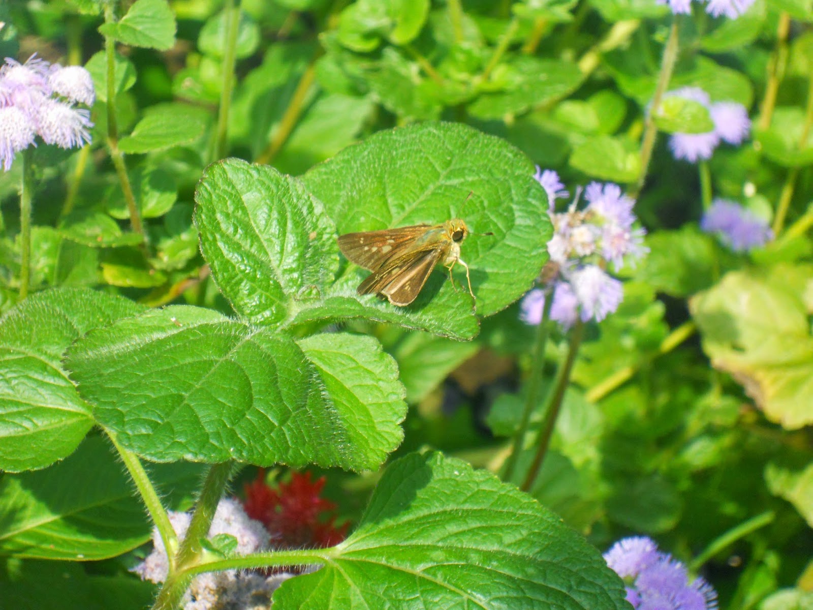
| Lots of these fellows around in the summer. They are quite shy, and may hide if you get too close. |
Past this site, the road arrives at a ramp leading up past an ornate gate to the entrance of Zuisen-ji (瑞泉寺). This late Kamakura Period temple, which became favoured with the Ashikagas after Kamakura's fall, costs 200 yen to enter but is well worth an exploration. Sometimes called the 'Temple of Flowers', its founding priest, Musō Soseki, was a renowned garden designer, and the temple possesses tremendous beauty in its plants and rock gardens, architecture and natural scenery, above all for the seasonal flowers that give it its nickname.


 |
| This temple has many yagura. |


Now it is time to head back into the hills. Exiting the temple, turn left at the signposted crossroads, and look out immediately for a narrow alleyway to the left. This is the trailhead for the Ten'en Trail, which crosses the northern hills of Kamakura.
 |
| Start of the Ten'en Trail. |
The climb is straightforward, though there are a couple of forks where you should follow the signs to Ten'en and Kenchō-ji. Look out for more yagura, and the Kaifuki Jizō (買吹き地蔵) statue above on the right.


 |
| Kaifuki Jizō (買吹き地蔵). |
The story of this jizō is intertwined with that of Hōjō Takatoki, the last regent of Kamakura who committed suicide in the yagura you passed earlier. It is said that one of his retainers took his head and fled into the hills, looking for somewhere to hide it from the besiegers. Apparently a jizō appeared and directed him to a valley nearby, where he safely buried the head then had this statue built in gratitude.
After further progress past more yagura, some flags and a tea house will come into view. Work your way above the tea house to find a boulder you can stand on for an excellent view across the town.
 |
| That is Kamakura on the left. This perspective well captures the impenetrability of its surroundings. |
Standing with the boulder behind you and the tea house below on your right, go straight ahead up the path to another tea house: this is Ten'en (天園). Both of these establishments sell food and drink and are viable places to stop for lunch.


Just past Ten'en, a golf course unfolds on the right. Head past this, and the large white country club building, to reach a clearing, at the end of which is a rocky projection. The top of this is Ōhirayama (大平山), the high point of Kamakura. There are more good views here, and if you brought your own lunch then this too is a pleasant place for a rest.


 |
| Another angle on the town and its dense surroundings. |

When ready, the path leads on into more woods. Follow signs to Kenchō-ji whenever it forks, and head on through a scenic rocky section with many yagura.


 |
| Some very old statues. The grey boxes have holes on top, perhaps for incense sticks. |
Eventually the path arrives at the well-marked back entrance to Kenchō-ji (建長寺), one of the greatest Zen temples in Japan. There is a lookout platform just below the map board which overlooks the temple grounds, and beyond it the town and the sea.
 |
| Some more little spiders. These are often found two to a web: a large female in the middle, and a smaller male nearby. |

 |
| Kenchō-ji rear entrance. |
 |
| Kamakura and the sea, seen from the north. |
 |
| The extensive grounds of Kenchō-ji temple. |
Our route, however, continues past this temple and on along the hills. Hereafter look out for signposts to Meigetsu-in, and ignore a right turn to Imaizumidai 4-chome. Before long the path will descend into a residential area.
Go on straight to the end of the road, turn right down the slope, then left at the next T-junction. This road leads south into the centre of Kita-Kamakura, and there are several yagura along here as well.


In a few minutes Meigetsu-in (明月院) appears on the left. This is another Kamakura Period temple, but the current structures were part of a much larger compound, called Zenkō-ji, which gained most fame and prestige thereafter as the family temple of the mighty Uesugi clan. Most of it was destroyed after the Meiji Restoration, when the rise of state Shinto brought a clampdown on Buddhism. Only the current Meigetsu-in sub-temple survived, and you can pay 300 yen to see its famous summer hydrangeas, some beautiful Zen gardens, and the city's largest yagura.
 |
| Entrance to Meigetsu-in (明月院). |


 |
| The largest yagura in Kamakura, with a tomb thought to be that of founder Uesugi Norikata, and just-visible statues of the Sixteen Arhats. |


Stage 3: Daibutsu Trail
Exiting Meigetsu-in, continue down the road for a few minutes, up to the railway. Turn left, then immediately traverse the level crossing on the right. Cross the road straight away, to take the left turn leading up to Jōchi-ji (浄智寺). This temple was built by the Hōjō clan and co-founded by two Zen masters invited from China, as the founding priest felt too young to be worthy of opening it himself. It is mostly a reconstruction, as the original was devastated by the Great Kantō Earthquake in 1923.
 |
| The approach to Jōchi-ji (浄智寺). |
As you head up, the temple is on the right, while the route on is left. The latter rises yet again into woods, and is the start of the Daibutsu Trail, the last of the three, which crosses Kamakura's western hills.
Take this path up to Kuzuharaoka Shrine (葛原岡神社), following signposts as needed.
 |
| Kuzuharaoka Shrine (葛原岡神社). |
This shrine stands on bloodied soil. In fact it was an execution ground, where in 1332, the year before Kamakura's fall, a man called Toshimoto Hino was decapitated. Hino, whose grave is nearby, was another imperial loyalist, and was arrested, twice, for conspiracies to overthrow the Kamakura Shogunate. The Meiji Emperor proposed this shrine in 1888 to commemorate him, and a memorial service is still held to him here each June.

 |
| The masaru-ishi in front of the shrine. Put 100 yen in the box, and as the sign reads, you can 'throw the dish at the rock to be rid of all malign influences in life, which are recognised as forms of impurity that disrupt the flow of life energy and suppress the potential for positive human development...Throwing the dish at the rock symbolises the overcoming of various obstacles in life'. |
 |
| One of the shrine's sleepy residents. |

Exiting the shrine, go straight to the end of the broad frontal approach road, turn left at the signposted fork, then left again at the vending machines to enter Genjiyama Park (源氏山公園). As Kamakura is so crowded with heritage, this hillside park holds some of its few open green spaces, and is a popular picnic site. It has an impressive 2m-high statue of Minamoto no Yoritomo, and is reputed for fabulous sakura during the spring cherry blossom season, as well as its other seasonal flowers and autumn colours.
 |
| Genjiyama Park (源氏山公園). |

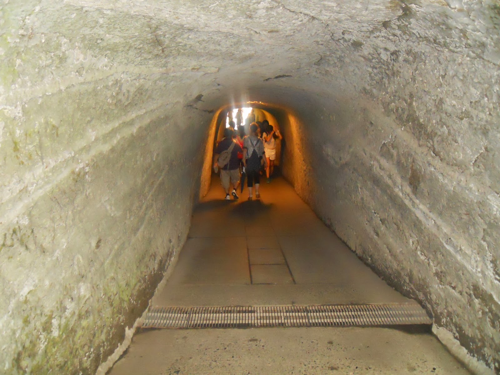
After wandering or resting in the park at your discretion, return to the vending machines and follow the road down, ignoring turnoffs, until you come to an unmissable shrine entrance in front of a tunnel. This is Zeniarai Benten (銭洗弁天), and the walk leads through the tunnel into the shrine proper.


This shrine's story also involves Yoritomo, who was apparently visited in a dream by the god Ugofukujin, who directed him to find the holy spring on this site and make an offering of its water. This happened on the day, month and year of the Snake, so the snake theme is ubiquitous here. What will stand out most however is the custom for visitors to head to the cave at the back, where the spring is, and wash their money in it; it is said that this money will then bring bountiful returns when invested.
In the back left corner of the shrine, past two rows of wooden torii, are some stairs leading up. Climb them, then descend some more stairs into a residential section, where you should go left then right at the next two forks to reach a long series of red torii.

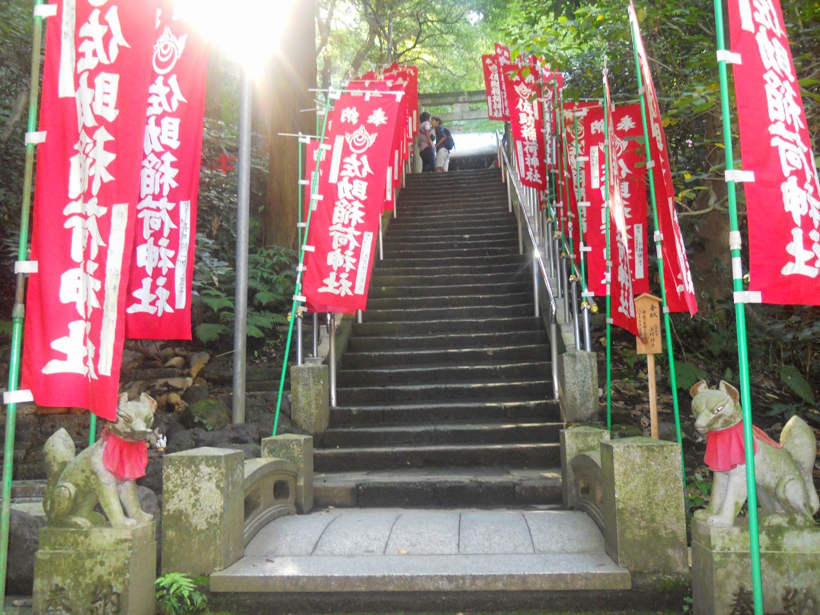
These lead up to the secluded Sasuke Inari Shrine (佐助稲荷神社). Here we have another story involving Yoritomo being visited in his dreams by old men – in this case Inari, a prominent and rather complicated Shinto god varyingly depicted as male, female or androgynous, old or young, or even a collective group of several deities. In this case Inari was living in a hidden hermitage in the Kamakura hills, and advised Yoritomo to take up arms against the Taira clan. After defeating them and establishing his government in Kamakura, Yoritomo sought out Inari's secret hamlet and found it here, represented by a tiny shrine which he replaced with today's larger shrine.
Inari is associated with foxes (kitsune), and this shrine may justifiably give you the impression that it has accumulated nine tenths of all fox likenesses in Japan.


The shrine's position in a shaded gully reflects that story of the hidden hermitage, and also accounts for the tough burst of climbing coming next. Behind the shrine there is a short but steep rise, which you should climb to rejoin the main Daibutsu Trail. Turn right at the top to reach it, then left to continue along.
This is the day's final stretch of walking through woods, and eventually you emerge into a small clearing that ends at a fork on stairs. Go left down these to reach the road, alongside the Daibutsu Tunnel which marks the Daibutsu Pass, one of Kamakura's historic Seven Entrances.
 |
| The end of the Daibutsu Trail, with the tunnel behind on the right. |
Heading straight on up the road, the iconic Kamakura Daibutsu (大仏) or Great Buddha statue is five minutes ahead on the left. Admission is 200 yen, and an extra 20 lets you go inside the statue.


Stage 4: Yuigahama beach
By this stage you will have successfully walked the three sides of Kamakura's surrounding hills. If you can take no more, go on past the Daibutsu to come in a few minutes to Hase Station (長谷駅) on the Enoshima Electric Railway, just a few stops from Kamakura Station. But you have it in you to walk a little bit further and close the circuit, proceed past Hase, turning left at the end of this road then right as soon as you can, to come out onto Yuigahama beach (由比ヶ浜海岸).


Turn left, and wind down this walk with a relaxing stroll by the sea. It will likely be quite crowded, as it is now enjoyed by many tourists, but do not forget that the sand you tread on has a long history as a battlefield and training ground.


Eventually you will reach a large canal discharging into the sea, with a wooden bridge across it. Leave the beach here: there will be an intersection with a Lawson on the left and koban on the right if you are in the right place. Proceed up the road between them, and after one final trek, you will pass under the rail bridge you saw near the start of this route. Kamakura Station is through the streets on the left shortly after.


 |
| If you did the full route, you will likely be exhausted by now, so congratulations if you managed it all. |
No comments:
Post a Comment