

Many fine
mountains rise up in the wilderness of Oku-Tama in western Tokyo. A
couple are covered on this blog: the sacred Mitake-san
and pointy Ōdake-san,
as well as the Takamizu
three mountains.
Further
in are the more serious mountains, like the forested pyramid of
Gozenyama over Lake Oku-Tama, and the lush and rocky valleys and
streams of Kawanori. Neither of these are featured here, as I have
saved them for a Tokyo hiking guidebook I am currently writing (and
seeking editorial oversight and publishing for – feel free to leave
a comment if you know anyone who might be interested).
And
then, deeper still, you have buggerations like these.

The high peak on the right is the 1737m-high Takanosu-yama (鷹ノ巣), or “Falcon's Nest mountain”. Still within the Tokyo Metropolitan Area, it is a herald, the first prominent peak on a ridge that rises west to Tokyo's edge, to Kumotori-yama, the capital's highest mountain at 2017m. It is said that during the Edo period, government officials would come to Takanosu to hunt hawks – and wanted to keep the birds to themselves, so had the mountain placed off-limits to the general public.
Nowadays the government won't stop you, but you still have to
convince the mountain itself of your worthiness. For a good
challenge, scale it from the north side, starting in Nippara, one of
Oku-Tama's isolated mountain villages famous for its limestone caves.
This confronts you with a nasty, calf-crunching sustained ascent up a
vertical distance of 1.5km, a gauntlet of narrow slope trails and
merciless gradients. After reaching the summit, another four hours
along the gentle but neverending Ishi Ridge will return you to
Oku-Tama town and the train station. And if you are feeling
particularly insane, you can do this now, in February, where peak and
ridge alike soar high above the snow line and those punishing trails
are locked in ice. Like this.

 |
| Yes, that is the path. |
 |
| And so is that. Doesn't it look fun? |
But if you do, you may just find that the mountain agrees that
insanity is better, indeed, than “normality” in a world at any
rate gone mad. And it will reward you, in proportion, as you stagger
onwards and upwards, puncturing at last through that mad world's
ceiling to come upon a landscape of utter wildernesses of freedom,
more formidable than you could ever have the right to expect so close
to a world-class urban colossus like Tokyo. And beyond the peak, you
may just find you have the ridge all to yourself: an authentic and
haunting winter wonderland, where furry animals stop to watch you,
mountains line the horizons, and the madness of humankind fades to
oblivion.

Needless to say, this is not a picnic. “Insane” is not the same
as “careless”. Takanosu in the snow is right up against that
difficulty threshold where specialist ice equipment becomes
mandatory; crampons or at least a hiking stick will do you no harm.
Sturdy shoes with good grip are essential, as are a map and a
compass. At times the ascent becomes a full-scale scramble on all
fours and a serious test of body and mind, and under no
circumstances, save the most extreme, should it be attempted in wet
conditions, especially at this time of year. Start early and plan
absolutely to be down by sunset, and over-estimate how much food and
water you will need, for the ice and snow will wear you down fast.
Note too that the entire route, though well-signposted and hard to
get lost on, is unserviced by shops or facilities.
Above all, treat the mountain and its life with respect. You don't
have to submit, but nor should pride have a place in your rucksack.
Deal with the mountain as an equal; teach it and learn from it. If
you do, then the trees, the rocks, the snow and the mountain itself
will be your friends and help you on your way. Literally, as we shall
see.
Oh, and watch out for bears.

Takanosu-yama
Length: 15.7km – or 32,161
steps, as reckoned by Comrade Nintendo 3DS step counter.
Hiking time: Allow at
least
8 hours.
Height: The first 3 hours
are a sustained climb from 630m (in Nippara) to the 1737m peak of Mt.
Takanosu. The rest is much gentler but very long, with some short
steep descents on occasion.
Access: Take whatever train
line is convenient out west to Tachikawa, then ride the Ōme
Line
all the way to the end, to Oku-Tama
station.
Then take Nishi-Tokyo Bus
No. 20,
right outside the station, to Naka-Nippara
bus stop (中日原),
which takes 28 minutes and costs 450 yen.
Click
here for bus timetable: left column for weekdays, middle for
Saturdays, right for Sundays and public holidays. From central Tokyo
this whole journey takes about two and a half hours, so be sure to
plan precisely
with train and bus times.
STAGE ONE: Inamura Rock
When you get off the bus at Nippara, this lordly formation will loom
before you.

This
prominent piece of enormity is not the mountain, but Inamura Rock
(稲村岩),
and getting on top of it is the first concern of the day.
 |
| Even though its very appearance tells you it is pointless to consider such a thing, and that instead you might prefer to bugger off out of there. |
It takes about an hour. Look for a signed path down some stairs, by
the building immediately right of the blue truck in the photo. The
trail descends into the woods, and after a tricky bit of scrambling
over narrowness, crosses a bridge across the Nippara River.

 |
| “Watch your step from here on.” |


This is where the climbing starts. As strenuous as it gets, remember
that this is all an appetiser ahead of the impending ordeal. Soon
enough you will reach the picturesque ravine that hugs the north wall
of Inamura Rock, which towers imposingly on your left.


Follow the trail as it winds amidst rocks and bridges, up and around
the Rock's north face. The landscape suggests there may be water
flowing here at less obscene times of the year, but I cannot confirm
this. After some good hard climbing you will get around behind it and
reach a shoulder, where a signpost points left for the top of Inamura
Rock and right for Takanosu-yama proper.
 |
| At the shoulder of Inamura Rock. |

The rocks are solid enough to clamber some way out towards Inamura
Rock's crown, but the cliffs become quickly precarious, so don't do
anything reckless.
 |
| Keep an eye out for these tiny red bugs who live on the rocks here. |
STAGE TWO: Getting to the top of Takanosu without getting
killed
This is where the fun starts. Straight away, in fact.

For most of the next two hours, the gradient will be approximately
like that or tougher. The first few paces are simple enough, taking
you through some pleasant beech woods.


And then comes the ice.

This photo faces back down the path, and if you look closely you will
notice that it is a switchback, whereupon the actual trail is frozen
completely. Here, at the bottom of the snow line, is where the ice is
most problematic: and you will quickly distinguish between the white
snow, which is soft and reliable but scarce this far down, and the
grey ice, which is nasty, hard, and at its worst – like this – is
far too slippery to set foot upon. At all.
 |
| Stand on it, and you will fall. |
Sometimes this can be overcome by walking off the path rather than on
it, and the nicer white snow makes this easier. But as the way gets
steeper, you will come to sections presenting a binary choice which
is simply unfair: between the ice too dangerous to walk on, and the
slope too steep to walk on. So be prepared to make maximum use of
your hands, taking hold of whatever trees, rocks, or thick snow might
help you pull your way up, while scanning for safe footholds one by
one. This is what I meant by seeking the mountain's friendship,
because some sections here are nigh on impassable without it.
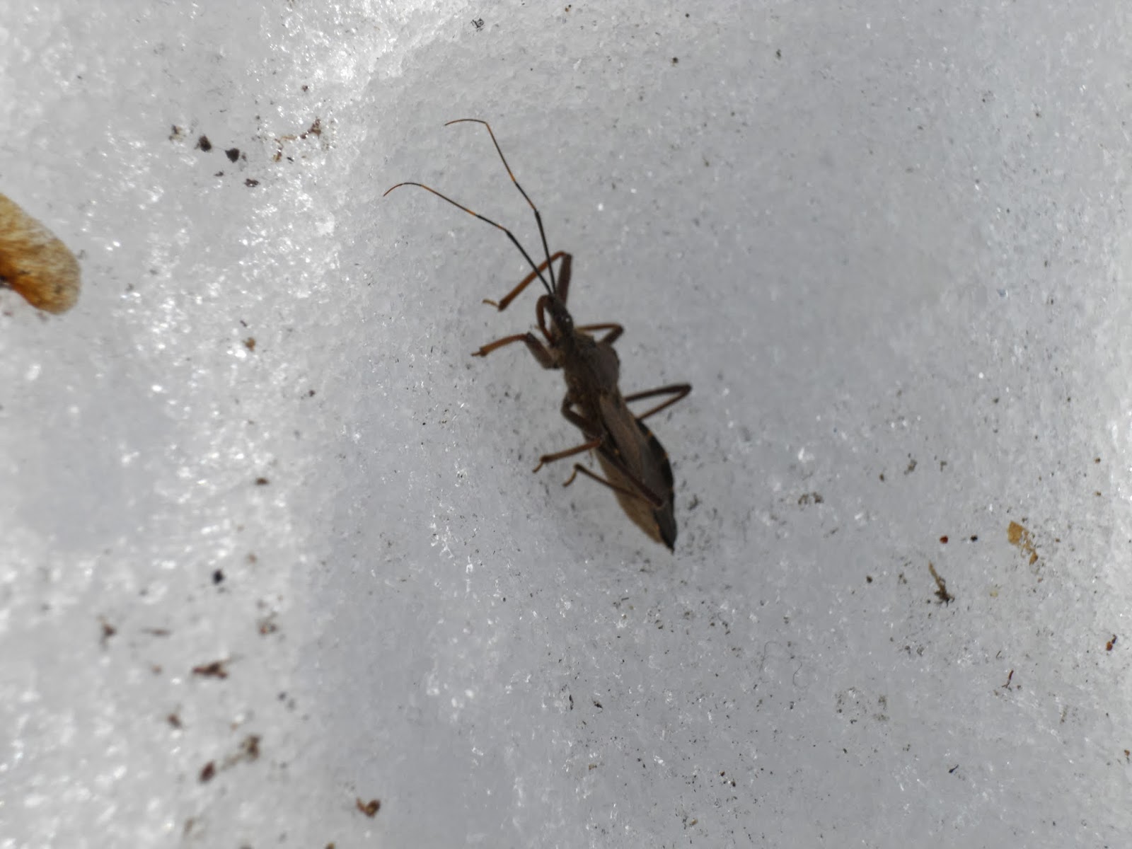 |
| A rare insect, disguised as a leaf, out and about in the snow. |


Be
prepared for bumps and bruises when you inevitably put a hand or foot
wrong. Be prepared to realise, after climbing for a while, that you
really
do not want to have to struggle back down the way you came no matter
what. Be prepared for it to feel long, because it is
long,
at times will feel like it never ends, like you are wrestling your
way up the snow and the ice and the rock as the earth saps your
strength remorseless.


Eventually you will clamber exhausted upon this plateau, with the
final approach to the peak in plain sight. Even that may by now look
impossible, so this is as good a place as any to find a log to sit on
and recharge yourself with some rice balls.
Take comfort, in the final push, in the knowledge that although some
five hours of long, hard slogging yet awaits, you have already
overcome the most punishing and technically ruthless of the
mountain's ordeals.

After hours of thick woodland, the summit will be your first open
field of view. Your entrails will scream with cathartic release as
soon as you glimpse this.

For
there unfolds a land that precedes us all by millions of years,
ancient when the human race was young. And closer, more massive in
your face than photographs can attest, Mount
Fuji
contends its place among the mountains.


 |
| The view west. On the right: Mt. Kumotori, the highest mountain in Tokyo. |
 |
| The view south: Mount Fuji. |
 |
| The view east towards Tokyo. |

 |
| This advisory for care on frozen winter paths refers back to the path up from Nippara. It isn't kidding. |
STAGE THREE: The long ridge back to Oku-Tama town
You now get an exemplary winter ramble along the eastern ridge, which
eventually drops direct into Oku-Tama town. Mercifully the ridge is
gentler than the preceding ascent, by far, and can be taken at a more
relaxed pace and gait. But it should still be respected, for hours
yet of snow, mud, and wild isolation remain to be traversed.


Up here the snow on the path is thicker than the treacherous ice-rink surfaces earlier. This makes the path itself much easier to walk on, but be alert that the snow to either side may be deeper than you expect. Additionally, it has started to melt in places, reducing the earth to mud – but with the air still cool, it has yet to liquefy into the horrible sticky slipperiness of which mud at its worst is capable.


Now here you can have some fun. What normally might be an annoying
steep descent has been thickly snowed over, creating a perfect slope
for a sled. For lack of one, the snow is still dense and solid enough
to slide down on your shoes, while soft enough to give you some
traction (and thus the control to stop at your will), and deep enough
to cushion you if you fall.
If you keep your eyes open – or better still, your ears – you
might even observe some woodpeckers.

The ridge traverses a few minor peaks, and is broad enough that you
can generally go over or around them as you please. Keep a lookout to
your right for glimpses of Lake Oku-Tama, Tokyo's largest lake and an
important source of its drinking water.

And then, if you are lucky, the fuzzy animals might make their
appearance.


 |
| A tree with an air of haunted aggression. “That way...” |

If you can still bear to climb, there is a worthwhile five-minute
signposted detour to the top of Mutsuishi-yama (六ツ石山),
at 1479m. The view is not as superb as on Takanosu, but still offers
good vistas of the surrounding mountains.
 |
| Mutsuishi-yama. |

 |
| You can see the whole route on this. Note that north is downwards. The red label near the centre is Nippara, the start point; the diagonal line which runs up and right from there is the ascent, which joins the other lines at Takanosu's summit. From there follow it all the way left, past the white box marking this map's location at Mutsuishi-yama, and finally into Oku-Tama town, the big clump in the grey valley. |

 |
| Hmm... |
The snow cover will now be coming and going as you gradually return
to the human world. Pay attention the route here: you want to stay on
the main ridge for as long as possible.
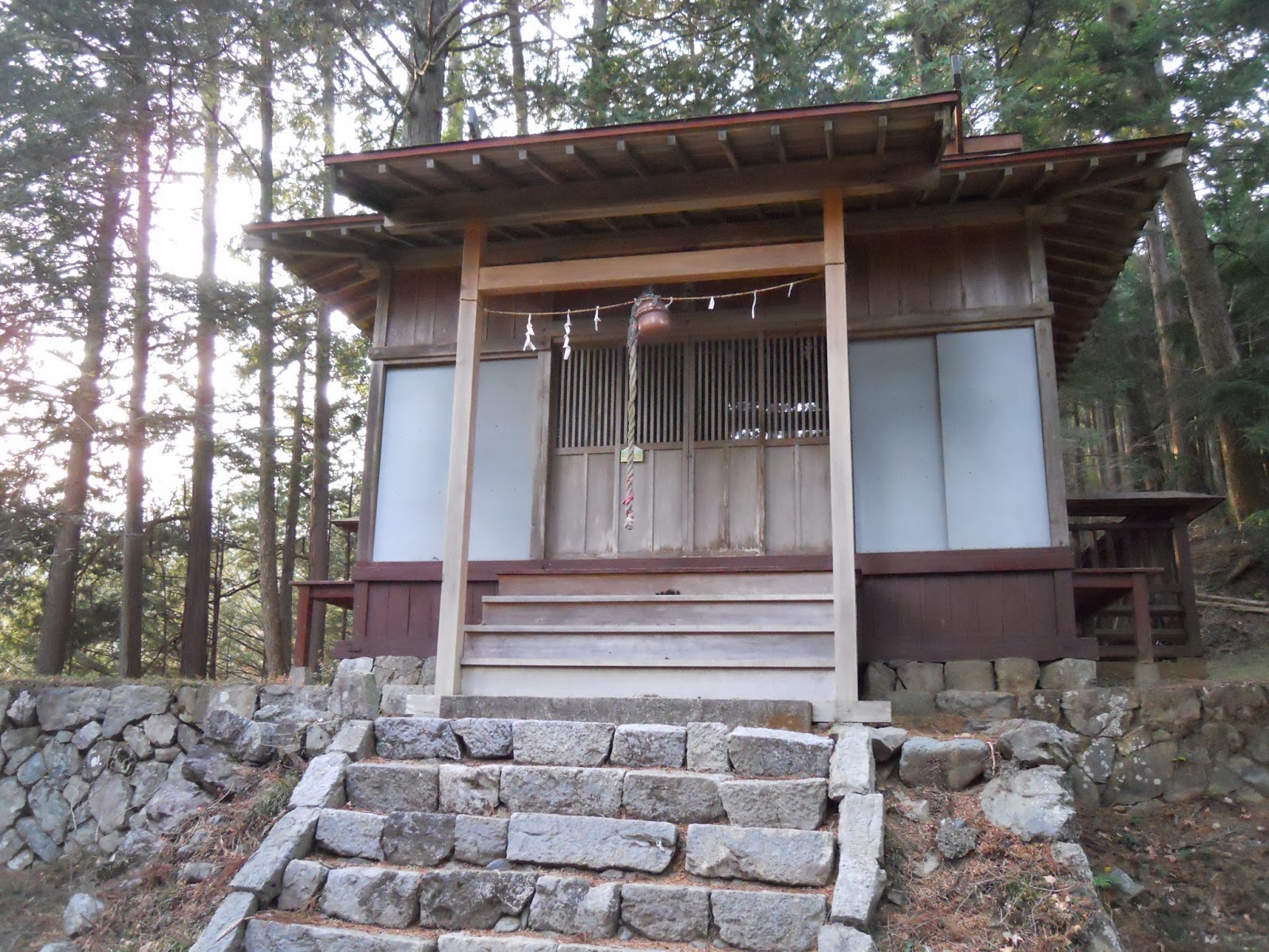
 |
| Shrine to a local mountain god. |

Soon after passing this rocky outcropping on your left, the path will drop sharply, though the ground's good condition should make your descent gentle enough. Stay on the ridge, ignoring signposted turn-offs to Sannokido village, and pass another peak, Sannokido-yama, following the trail round its north (left) this time.


 |
| The views keep coming. |

 |
| The ice is not done with you yet. Do not get complacent at any point. |
 |
| It is as slippery as it looks. If this is a struggle, the trees on the left offer good footholds. |
At last, after what seems an age, the ridge dips away into sugi
plantation forest. There is still some way to go before the end, but
as the signs keep suggesting, you now know that you are making your
way, slowly but surely, down and out of that special and mysterious
world in the mountains.


 |
| The road back. |
 |
| Another small shrine, this time with some donations evident. |
 |
| On that day, one of the only suggestions I encountered that humanity exists. |
 |
| When you see this shrine, you are almost out of the woods. |
Until eventually, the path joins a mountain road with few cars, but
which leads back to humanity nonetheless.
 |
| The white warning sign, referring back up to the ridge, says “Beware of appearing bears!” It goes on to explain that at 10am on October 21st, a bear appeared in this area, and that anyone entering the mountains this way should carry a bell, radio, or other sound-producing equipment without fail. |
Turn left on the road and follow it
into Hikawa, in the outskirts of Oku-Tama town, ignoring an early
left turn. Soon houses will appear, and you should look out for
shortcut staircases down which cut through the switchbacks. One of
these will land you at the Haguro Shrine (羽黒神社);
cross its grounds and leave opposite its front face, bearing left,
and soon the town centre will come into sight.


 |
| Haguro Shrine. |
 |
| Oku-Tama town. |
From there the end is straightforward. Keep going until you join
National Route 411, then cross the Hikawa Great Bridge and turn left
at the traffic lights to achieve what will have been unimaginable for
most of the day: that is, to reach Oku-Tama Station and the train
back to Tokyo.

 |
| Or you could turn left here, walk a few hours up the road back to Nippara, and do it all over again. |
 |
| Hikawa Bridge. |
 |
| Oku-Tama station. |
If you manage all that, then heartiest congratulations – it would
not be unforgivable to permit yourself a modicum of pride for it.
Also, do not expect to be able to physically move for the next few
days.

No comments:
Post a Comment